Home > Mapping Tools
Mapping Tools
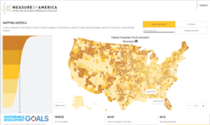
Mapping AMERICA
WELL-BEING IN THE UNITED STATES
With over 100 indicators, this is a tool to understand well-being and human development in America. Users can plug in their zip codes to locate human development levels within their own communities, compare places and indicators, and more.
Features:
- Interactive mapping tool
- Over 100 indicators
- Downloadable data
- State, city, county, congressional districts, select cities
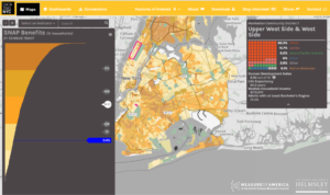
DATA2GO.NYC
WELL-BEING, RESOURCES, AND NEED IN NEW YORK CITY
Measuring what matters for well-being and opportunity in New York City, DATA2GO.NYC brings together federal, state, and city data for the first time at the neighborhood level. It’s free, easy to use, and it’s been updated annually for years.
Features:
- Mapping, dashboard, and connections views
- Over 350 indicators for NYC’s 59 community districts
- Over 150 indicators available by census tract
- Downloadable data

YOUTH DISCONNECTION INTERACTIVE SITE
INTERACTIVE DATA AND MAPPING TOOL
Disconnected youth, also called opportunity youth, are young people between the ages of 16 and 24 who are not in school and not working. This interactive mapping and data visualization tool provides key data related to the opportunities available to teens and young adults from different racial and ethnic groups and in different parts of the country.
Features:
- Data for states, cities, counties, congressional districts, and PUMAs (Public Use Microdata Areas)
- Interactive, customizable visualizations, showing change over time for several geographies
- Detailed data on characteristics of disconnected youth
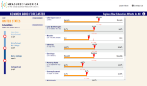
COMMON GOOD FORECASTER
SHOWING THE IMPACT OF EDUCATION
Using the latest statistics from the U.S. Census Bureau, the Forecaster shows how education affects our lives. Change the level of educational attainment in your own county or state to see how education impacts important economic, social, and political variables.
SHOWING THE IMPACT OF EDUCATION
Using the latest statistics from the U.S. Census Bureau, the Forecaster shows how education affects our lives. Change the level of educational attainment in your own county or state to see how education impacts important economic, social, and political variables.
Features:
- Interactive forecasting tool
- Uses statistical models drawn from peer-reviewed studies to predict the effect increased levels of educational attainment are likely to have on other important variables
- Downloadable data
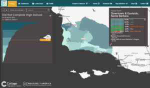
Cottage Data2Go
SANTA BARBARA MAPPING AND DATA TOOL
Cottage Data2Go is a free, easy-to-use online mapping and data tool created by Cottage Health and Measure of America of the Social Science Research Council. It brings together federal, state, county, and community data on a broad range of issues critical to the well-being of all Santa Barbara County.
Features:
- Mapping, dashboard, connections, and health views
- Data on municipal services, philanthropy, schools, and other civic institutions
- Nearly 200 indicators available across the census tract, city, and Census-designated place levels
- Downloadable data
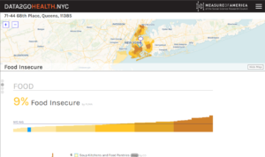
NYC Health Mapping Tool
DATA2GOHEALTH.NYC
DATA2GOHEALTH.NYC brings together federal, state, and city data on all things health, for all New Yorkers. The website includes over 300 indicators for New York City neighborhoods, and about half of these indicators are available by community district, and almost a quarter by census tract.
Features:
- Interactive mapping tool
- Over 100 indicators
- Downloadable data
- State, city, county, congressional districts, select cities